Summary Box: FieldCalc GPS Area Measure makes it easier to estimate land area, boundaries, distance and perimeter using a smartphone. This guide covers the app’s useful tools, measurement methods, practical tips and important limitations.
What Is FieldCalc GPS Area Measure?
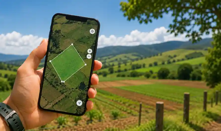
FieldCalc GPS Area Measure is a mobile application created for measuring outdoor spaces such as farms, plots, gardens, yards and other properties. Instead of depending on manual calculations, users can work with a digital map and mark points around an area to get an estimated measurement. This can be useful when you need a quick idea of the size of a property before planning farming, landscaping, construction or other work.
The application can work with different types of measurements, making it useful for both simple and irregular areas. Users can measure area, distance and perimeter, while supported measurement units can make the results easier to understand. It is important to remember that GPS-based measurements are estimates and should not replace a professional survey when exact legal boundaries or official property measurements are required.
Table of Contents
FieldCalc GPS Area Measure: How It Works
The main process involves selecting points that represent the boundary of the area. You can place points directly on a map or use GPS while moving around the property. Once the boundary is completed, the application calculates the enclosed area and can provide additional information such as perimeter or distance.
Accuracy can vary depending on GPS reception and the surroundings. Open outdoor locations generally provide better conditions than areas surrounded by tall buildings, dense trees or other obstructions. For a more useful estimate, walk along the actual boundary carefully and avoid placing points too far inside or outside the property.
How to Measure Land With FieldCalc
- Open the Measurement Tool
Launch the application and choose the appropriate area or field measurement option. Allow location access when you want to use the GPS-based measurement feature.
- Select Your Measurement Method
Choose between placing points manually on the map and using GPS while moving around the land. Manual mapping can be convenient when you already know the approximate boundary, while GPS mode can help when you are physically present at the location.
- Mark Every Important Boundary Point
Move around the property and record the corners and significant changes in direction. Irregular plots may require several points to represent the shape more accurately. Complete the boundary before checking the calculated result.
- Select a Suitable Unit
Depending on the available options, measurements can be viewed in units such as square feet, acres or hectares. Select the unit that makes the result easiest to use for your particular purpose.
- Review and Save the Result
Check the calculated area and perimeter before saving the measurement. Keeping separate records can be helpful if you are comparing several plots, planning agricultural work or managing multiple properties.
Useful Features to Explore
FieldCalc GPS Area Measure offers tools beyond basic land calculation. Depending on the version and platform, features can include GPS field measurement, map-based area calculation, distance measurement, perimeter calculation, coordinates and saved measurement records.
Some versions also provide options for handling complex areas. For example, certain measurement tools can account for sections that need to be excluded from a larger area. This can be useful when a property contains buildings, ponds or other spaces that should not be included in the final estimate.
Is FieldCalc Accurate for Property Measurement?
A GPS measurement app is useful for quick estimates, but it should not be considered a replacement for a certified land survey. GPS accuracy can change because of signal conditions, device quality and environmental obstacles. If the measurement is needed for a sale, boundary dispute, registration, legal document or official land record, consult a qualified surveyor.
Frequently Asked Questions
Can I use FieldCalc to measure farmland?
Yes. The app is designed for measuring outdoor areas including fields, farms, yards and plots.
Can I measure an irregular-shaped property?
Yes. You can add multiple boundary points to represent an irregular plot and calculate the enclosed area.
Does FieldCalc measure distance?
Yes. Distance and perimeter measurement are among the useful functions associated with the app.
Can GPS measurements replace a land survey?
No. GPS applications are best used for preliminary estimates. Official property measurements should be handled by a qualified professional.
Can I use the app on a smartphone?
Yes. Field measurement applications such as FieldCalc are designed for mobile use, allowing users to perform measurements directly at the property.
Conclusion
FieldCalc GPS Area Measure can be a convenient solution for quickly estimating land size, distance and boundaries from a smartphone. Use the available GPS and map tools carefully, save useful measurements for future reference and rely on professional surveying whenever legally accurate measurements are required.
Internal Link Suggestion:
Pay Land Tax Kerala Online: 5 Brilliant Steps to Pay Easily
Official External Link(s):
FieldCalc Official Website
FieldCalc on Google Play
FieldCalc on Apple App Store